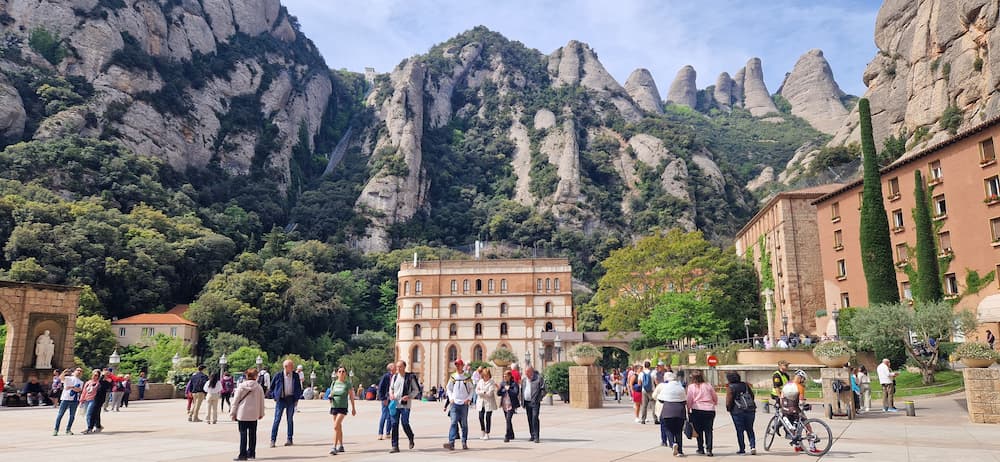
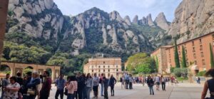
Montserrat hiking is the reason to stay on the mountain once you’ve visited the monastery. The massif reaches 1,236 m at Sant Jeroni, and everything from a ten-minute walk to a seven-hour loop starts from one of just two places: the monastery square, or the top of the Sant Joan funicular.
The problem is that most guidebooks categorize Montserrat’s trails by type—viewpoints here, hiking trails there—when the only thing that really matters to you is the level of exertion. Sant Joan is both a viewpoint and a hiking trail. That’s why this guide is organized by difficulty, ranging from a ten-minute walk on a paved path to the full 17-km circuit of hermitages, and each option listed below links to a comprehensive guide with maps, estimated times, and elevation gain.
For most visitors, the best option for hiking in Montserrat is the climb to the summit of Sant Jeroni from the Sant Joan funicular: 3.68 km each way and 1 hour 30 minutes uphill, for a total of 3 hours. It’s the most comfortable way to get to the top. If you only have an hour, take the Camí dels Degotalls or hike up to the Creu de Sant Miquel. If you want to spend a full day on the mountain, the 13-chapel loop is 17 km long with 770 m of elevation gain, starting from the monastery.
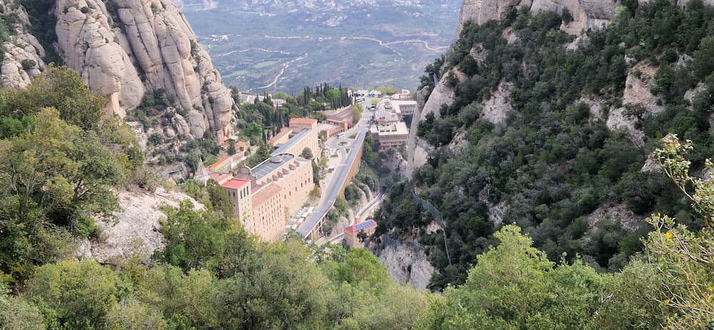
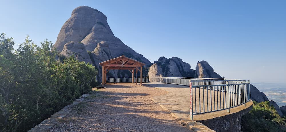
Montserrat hiking trails and viewpoints, ordered by effort
Six guides, one mountain. The table sorts them by how hard the walking is, not by whether the destination happens to be a viewpoint or a summit — because on Montserrat those are usually the same place.
| Trail group | Effort | Time | Starts at | Guide |
|---|---|---|---|---|
| Viewpoints near the monasteryEasiest | ★☆☆☆☆ | 10–55 min | Monastery square | See → |
| Easy walks from the monasteryNo funicular | ★★☆☆☆ | 25–60 min | Monastery square | See → |
| Sant Joan area viewpointsfunicular | ★★☆☆☆ | 5–45 min | Sant Joan funicular | See → |
| Sant Jeroni summitThe one to do | ★★★☆☆ | 1 h 30 one-way | Sant Joan funicular | See → |
| Other mountain viewpointsOther spots on the mountain | ★★★★☆ | 2 h 30 + on foot | Monastery square or by car | See → |
| The 13 hermitages circuitExperienced only | ★★★★★ | 5 h 30 loop route | Monastery square | See → |
1 · Viewpoints near the monastery — the easiest Montserrat views
If you have a couple of hours on the mountain and no intention of hiking, this is where you go. Four lookouts within walking distance of the monastery square, ordered from a paved stroll to something that starts to feel like a mountain path.
- Mirador dels Apòstols — 12 minutes, 808 m, almost no walking. The quickest scenic stop on the mountain
- Creu de Sant Miquel — 40 minutes, 1.45 km, 70 m of ascent. The postcard view of the monastery, and the best effort-to-reward ratio here
- Miranda de Fra Garí — 45 minutes, 853 m, 90 m of ascent. Quieter, and the best aerial view of the monastery square
- Miranda dels Ermitans — 55 minutes, 1.09 km, 150 m of ascent. On the Sant Jeroni path, past the Pas dels Francesos
For a first visit, the combination that works is Creu de Sant Miquel plus Mirador dels Apòstols: two completely different views without turning the day into a hike.
Best Montserrat viewpoints near the monastery →2 · Easy walks from the monastery — a Montserrat hike without the climb
These are proper walking routes rather than viewpoint stops, and all three start beside the sanctuary. None of them is a summit hike, which is exactly why they work on a day trip from Barcelona.
- Camí dels Degotalls — 25 minutes, 1.86 km, 10 m of ascent. Shaded, flat, with Marian ceramic tiles along the way. The easiest Montserrat hike there is
- Via Crucis — 40 minutes, 572 m, 20 m of ascent. Short but uphill, and the one that feels connected to the religious side of the mountain
- Creu dels Escolans — 1 hour, 2.16 km, 120 m of ascent. The first route here where footwear and heat genuinely start to matter
3 · Sant Joan area — six viewpoints from the top of the funicular
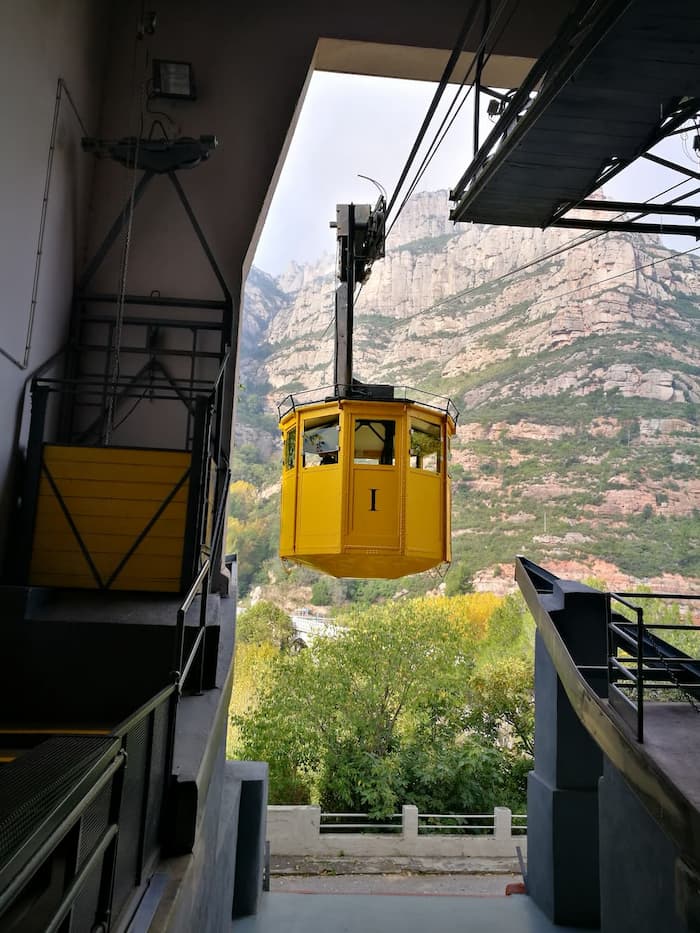
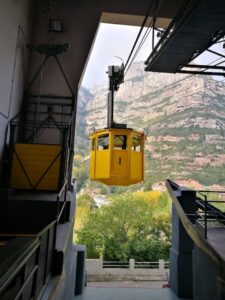
The Sant Joan funicular takes you above the monastery and drops you off at the starting point for six different viewpoints. This is, without a doubt, the best choice a visitor with half a day to spare can make: the most accessible viewpoint is right at the station, and the most challenging one requires a strenuous mountain hike.
- Aula de la Natura terrace — 2 minutes away, on the upper level of the station. Views of the Tebaida without having to follow any trails
- Pla de les Taràntules — 10 minutes, 218 m. La Trompa de l’Elefant, La Mòmia, La Prenyada and La Trumfa
- Mirador de Sant Joan — 35 minutes, 890 m, 50 m of ascent, around 1,073 m altitude
- Mirador d’Icona — 35 minutes, 1.17 km, on the Camí Nou de Sant Jeroni. A scenic stop if you are heading for the summit anyway
- Miranda de Santa Magdalena — 45 minutes, 882 m, 100 m elevation gain, approximately 1,132 m. The feeling of being on a true mountain summit.
- Mirador de Sant Jaume — exposed terrain and a Grade II scramble. Experienced mountain walkers only, and never in wet or windy conditions
Sant Joan is also where the easiest Sant Jeroni route begins, so this is the natural first stop if you are working your way up the mountain.
Sant Joan Montserrat: the funicular area viewpoints → Aula de la Natura Montserrat: the nature exhibition →4 · Sant Jeroni — the summit hike most visitors come for
Sant Jeroni is the highest point of the massif at 1,236 metres, and on a clear day the panorama takes in the Pyrenees, the Mediterranean and the whole Montserrat range. You do not need to be an experienced hiker to get there.
The easiest route runs from the Sant Joan funicular upper station: 3.68 km one way, 1 h 30 min up, 3 hours round trip, and it skips most of the elevation gain. The trail is well marked, wide for most of its length, with some stairs in the middle section and a final staircase to the summit.
- There are no water fountains on the route. Buy water at the Sant Joan upper station, where there are also toilets
- Street shoes are not enough: the route has rocky sections, stairs and sandy stretches
- Avoid the middle of the day in summer, even though parts of the trail are shaded
- Six different routes reach the summit, from this one to a 8.7 km ascent from Monistrol with 1,007 m of climbing

5 · Other mountain viewpoints — Verdaguer and Santa Cecília
Beyond the monastery and Sant Joan, the mountain range hides the viewpoints with the highest vantage points in the entire range, as well as two quiet viewpoints near Santa Cecília that almost no one visits and that are incredible.
- Sant Jeroni — 1,236 m, the full 360° panorama and the viewpoint by excellence of the mountain
- Mirador Mossèn Cinto Verdaguer — 1,171 m, right beside the summit. Views of Montgrós and the Ecos region, with a little less effort, next to the monument to the Catalan poet
- Mirador de Santa Cecília — behind the Monestir de Santa Cecília, a few hundred metres from the building. One of the quietest spots on the mountain. Park in Santa Cecília.
- Mirador del Refugi de Santa Cecília — beside the Refugi Bartomeu Puigròs, on the BP-1103. Great views of the massif with almost no walking. Park in Santa Cecília.
If you are arriving by car and short on time, the two Santa Cecília viewpoints are the best return on effort anywhere on Montserrat.
Other Montserrat mountain viewpoints →6 · The 13 hermitages — the hardest hike in this guide
A circular route that starts at the monastery and connects the ancient hermitages scattered throughout the mountain range: Sant Onofre, carved into the rock; Sant Jaume, perched halfway up Gorra Marinera; Santa Anna, which once served as a parish church for the hermits; and all the others. Most were destroyed in 1812 during the War of Independence.
This is not a tourist route. It combines steep ascents, technical sections, and areas where the path is not clearly marked, and there are hardly any water sources along the way, except at the upper station of the Sant Joan funicular.
- GPS with the track loaded is essential, and so is a full battery
- Start early: this takes most of the day
Which Montserrat hike is right for you?
Two hours, first visit
Creu de Sant Miquel and Mirador dels Apòstols. Two very different views of the monastery, and you are back in the square in under an hour.
Half a day, want the mountain
Sant Joan funicular, then Pla de les Taràntules and Miranda de Santa Magdalena. Maximum contact with the mountains with minimal effort.
A full day, decent fitness
Sant Jeroni from the Sant Joan funicular. Three hours return, the highest point of Montserrat, and the views everyone comes for.
Walking with children or grandparents
Camí dels Degotalls. Flat, shaded, 25 minutes, and it still feels like you have walked in the mountain.
Experienced in the mountain
The 13 hermitages circuit starting from the monastery, if you’re comfortable on exposed terrain.
Arriving by car, little time
Add the two Santa Cecília viewpoints on the BP-1103. Wide views of the massif with barely any walking at all.
Map of the Montserrat trails and viewpoints
The Montserrat trail map
Pick a group of routes and only those trails are drawn, on the official topographic map of Catalonia. Hover a route to highlight it, click to open its full guide.
Getting to the trailheads
Every trail in this guide except the Santa Cecília viewpoints and the hermitages circuit starts at the monastery square or at the top of the Sant Joan funicular, so the first decision is how you get up the mountain. The full comparison is in how to get to Montserrat from Barcelona, but for hikers the short version is this: if you want an early start, drive and leave Barcelona before seven. Otherwise take the rack railway, which runs all year.
FAQ — Montserrat hiking
What is the best hike in Montserrat?
For most visitors it is the Sant Jeroni summit from the Sant Joan funicular: 3.68 km each way, 1 h 30 min up, 3 hours round trip. It reaches the highest point of the mountain at 1,236 m while skipping most of the elevation gain. If you have less time or less appetite for climbing, the Camí dels Degotalls takes 25 minutes and the Creu de Sant Miquel viewpoint takes 40.
How long does it take to hike to Sant Jeroni?
From the Sant Joan funicular upper station it takes 1 hour 30 minutes one way, 3 hours round trip. If you stop for photos and walk at a relaxed pace, plan around half a day. From the monastery instead of the funicular the route is 3.7 km with 516 m of ascent, and it feels considerably harder.
Do you need to be fit to hike in Montserrat?
Not for most of the routes in this guide. The viewpoints near the monastery and the Camí dels Degotalls need no fitness at all beyond normal walking. The Sant Jeroni hike from Sant Joan is suitable for casual hikers, tourists with decent fitness and families with older children. Only the 13 hermitages circuit and the Mirador de Sant Jaume genuinely require mountain experience.
Can you hike in Montserrat without taking the funicular?
Yes. The Camí dels Degotalls, the Via Crucis, the Creu dels Escolans and all four viewpoints near the monastery start from the monastery square and need no funicular. You can also walk up to the Sant Joan area on foot, but it is much more demanding than taking the funicular.
What is the highest point in Montserrat?
Sant Jeroni, at 1,236 metres. It offers a full 360° panorama over the massif and, on clear days, views as far as the Pyrenees and the Mediterranean. The Mirador Mossèn Cinto Verdaguer sits just beside it at 1,171 m with similar views for slightly less effort.
Is there water on the Montserrat trails?
No. There are no water fountains on the Sant Jeroni route, and none on the hermitages circuit except in the Sant Joan funicular area. Buy water at the Sant Joan upper station, where there are also toilets, and carry enough for the whole route.
What should you wear to hike in Montserrat?
Shoes with grip, always. The routes include rocky sections, stairs and sandy stretches, and the paved paths around the monastery are polished stone that gets genuinely slippery in the wet. Montserrat sits at 720 m and is consistently cooler and windier than Barcelona, so bring a layer even in summer.
Continue exploring Montserrat
Read my Ultimate Guide to Hiking in Montserrat

If this guide helped you plan your visit, then it has done its job.
I’m based in Collbató, at the foot of Montserrat, and have been hiking and exploring the mountain for more than 20 years. Author of The Ultimate Montserrat Hiking Guide Book.
Some links may be affiliate links, at no extra cost to you.