If you’re planning a visit to Montserrat Mountain Barcelona and want to do the Sant Jeroni hike in the easiest way possible, without turning it into a long or exhausting trek, this is the route you’re looking for.
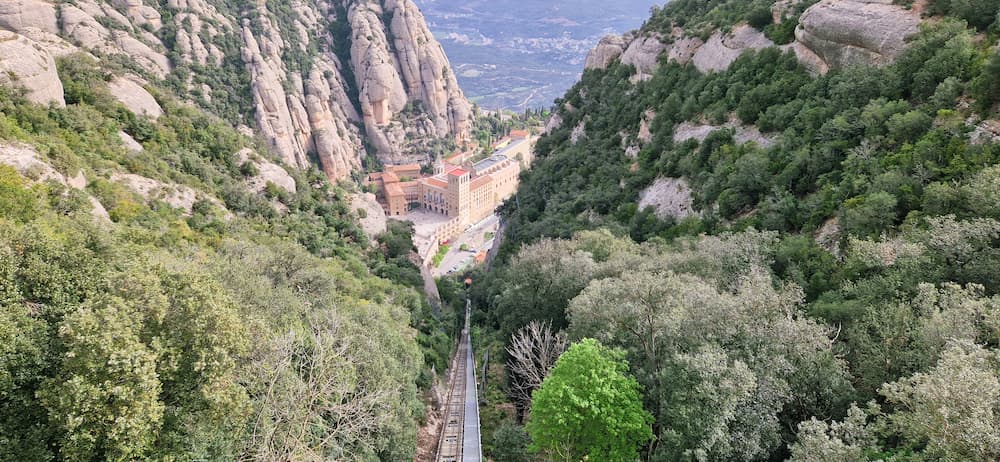
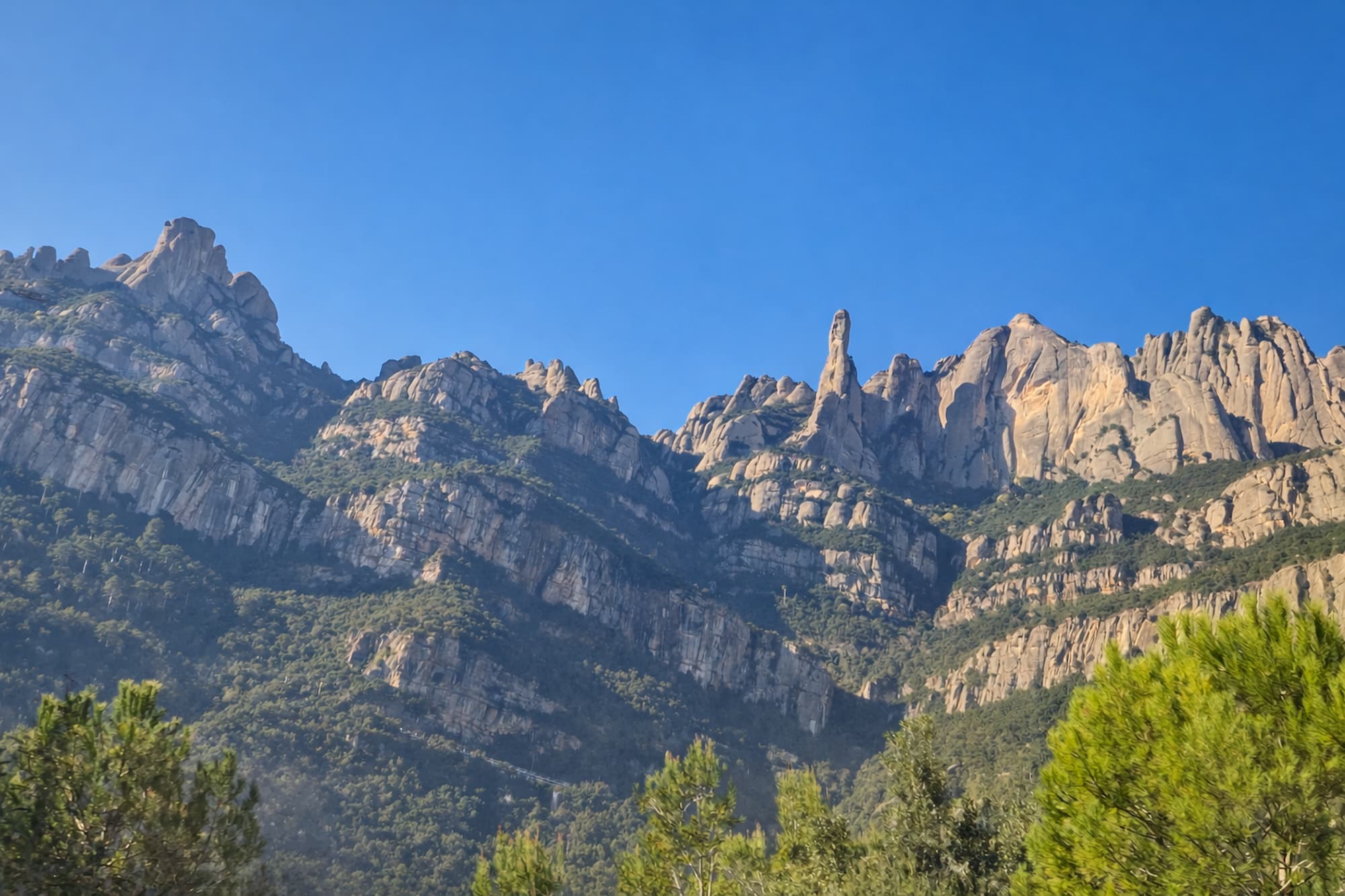
The Sant Jeroni hike is one of the most rewarding experiences on Montserrat Mountain. From the summit, you can enjoy panoramic views that span part of Catalonia and, on a clear day, the sea and even the Pyrenees.
The good news is that you don’t need to be an experienced hiker to do the Sant Jeroni hike. This guide shows you the easiest and most popular way to reach the summit, starting from the Sant Joan funicular.
Planning the Sant Jeroni hike from Barcelona?
Compare the easiest ways to reach the trailhead: guided tour, transport pass, rack railway or cable car.
Prefer a guided experience?
Compare the best Montserrat tours from Barcelona — rack railway, small group and private options.
Contents
The easiest Sant Jeroni hike to reach the summit
The easiest route to Sant Jeroni is Funicular de Sant Joan + short hike
This option allows you to:
- Skip most of the elevation gain
- Start high in the mountain
- Enjoy one of the most scenic trails in Montserrat
Quick summary:
- Start point: Sant Joan upper station
- Distance: ~3,68 km (one way)
- Time: 1h – 1h 30 min (one way)
- Difficulty: Easy to moderate
- Elevation gain: Low (compared to other routes). Only 263 meters.
Where does the Sant Jeroni hike start?
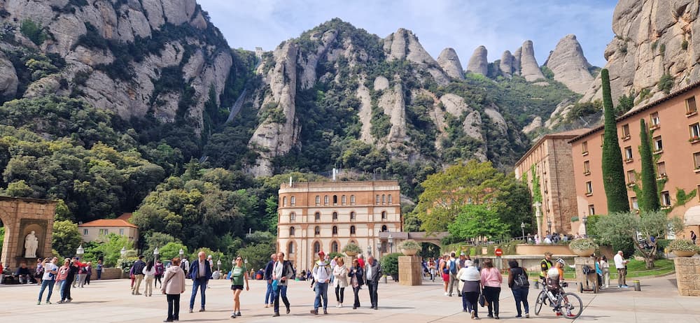
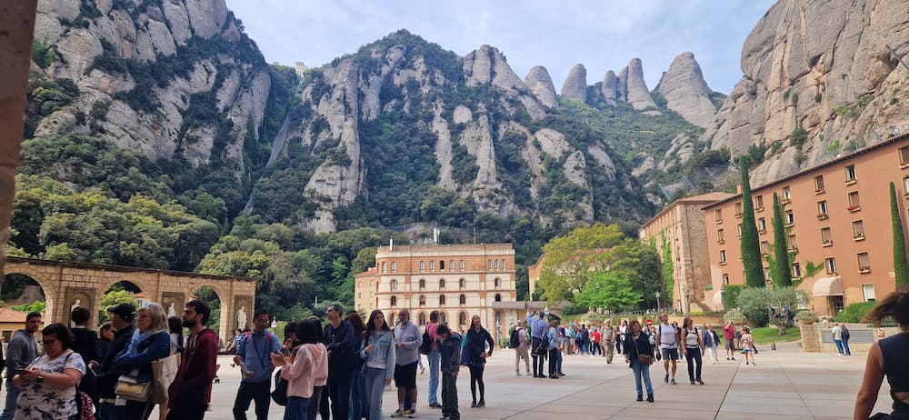
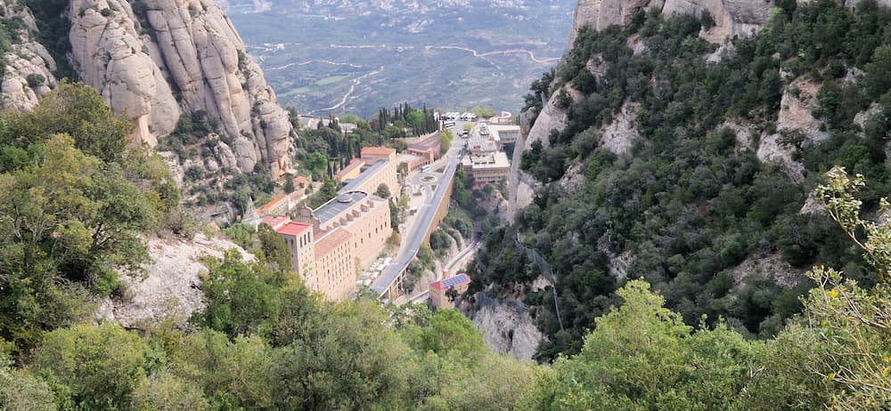
The hike begins at the Sant Joan funicular station, located above the monastery. This is one of the most convenient starting points on Montserrat mountain, especially if you want to reach Sant Jeroni without doing the full climb from the monastery.
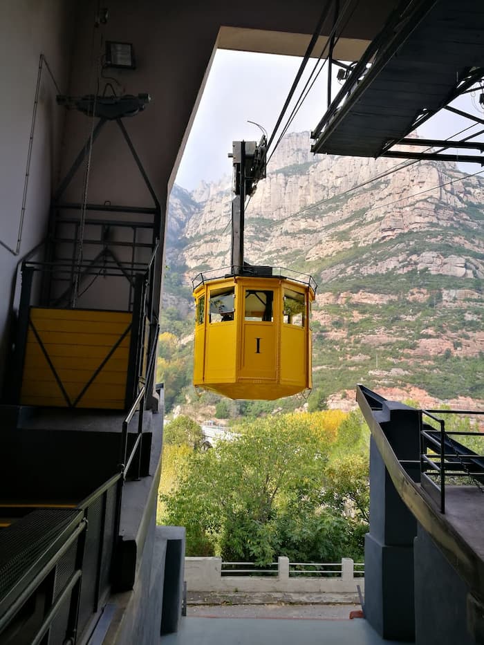
To get there, you first need to reach the Montserrat Monastery area. Most visitors arrive by rack railway, cable car or a guided Montserrat tour from Barcelona. The options below help you choose the best transport or tour before starting the Sant Jeroni hike.
Prefer a guided experience?
Compare the best Montserrat tours from Barcelona — rack railway, small group and private options.
From the monastery, take the Sant Joan funicular, which brings you up to the starting point of the trail.
How to reach the Sant Jeroni hike starting point
Before starting the hike, you need to get to the monastery.
If you’re coming from Barcelona, these are the main options:
Prefer a guided experience?
Compare the best Montserrat tours from Barcelona — rack railway, small group and private options.
This option is especially useful if you want to combine your visit with the Sant Jeroni hike without worrying about transport. If you prefer a more organized experience, a small group Montserrat hiking tour can be a good option, especially if you want to enjoy the monastery area, mountain scenery and part of the Sant Jeroni route without managing all the transport connections yourself.
If you’re not sure which option to choose, check our comparison.
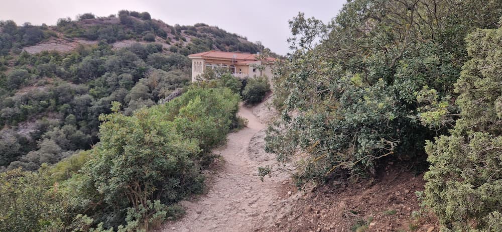
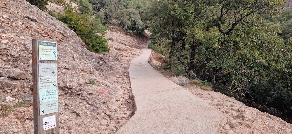
Sant Jeroni hike from Sant Joan
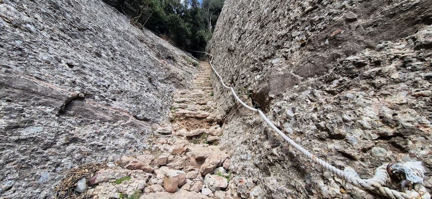
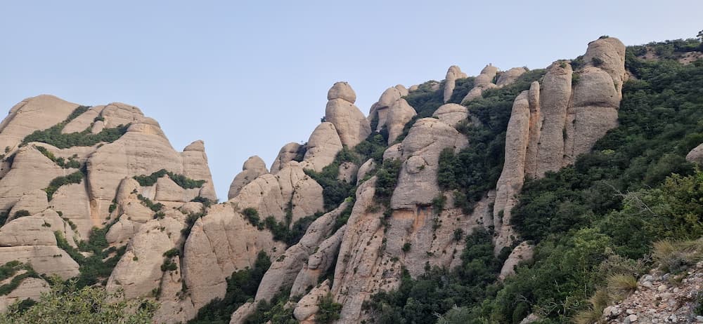
From the Sant Joan station, the path to Sant Jeroni is well marked and easy to follow. The trail gradually takes you deeper into the mountain, with incredible rock formations and viewpoints along the way.
What to expect:
- Clear signposting
- Wide paths most of the time
- Some stairs in the middle section and near the end
- Spectacular views throughout
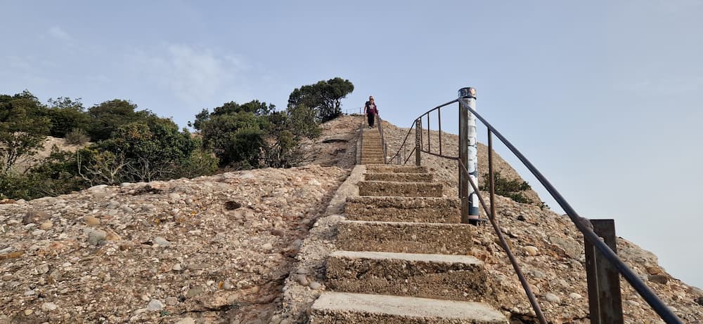
The last part of the hike includes a staircase that leads directly to the summit.
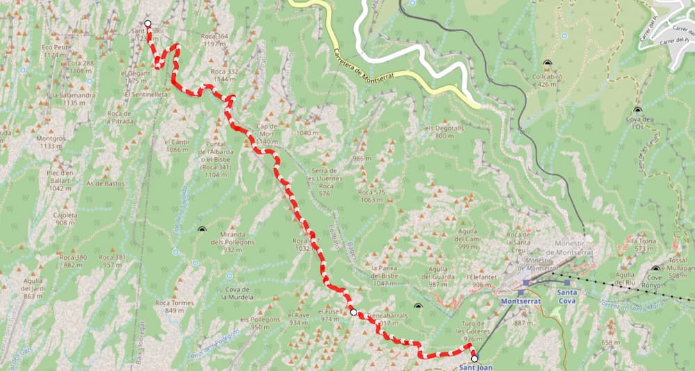
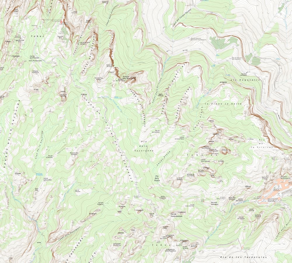
Sant Jeroni hike map in Montserrat
To better understand the route and plan your hike, it’s highly recommended to check a detailed map before starting. The trail from Sant Joan to Sant Jeroni is well marked, but having a clear overview helps you visualize the route, elevation, and key points along the way.
You can follow the exact Sant Jeroni hike route here.
This map includes:
- The full route from Sant Joan to Sant Jeroni
- Elevation profile
- Key viewpoints and landmarks
Download the Sant Jeroni hike map for offline use
If you prefer to have the route available offline, you can download a detailed map of the area.
Download the topographic map of Montserrat for this hiking area (Alpina / ICC)
This is especially useful if you want a more detailed topographic map of the Sant Jeroni hike and don’t have cell service.
- Difficulty: Easy
- Tip: In case of emergency, you can call 112
Is the Sant Jeroni hike worth it?
Yes — absolutely.
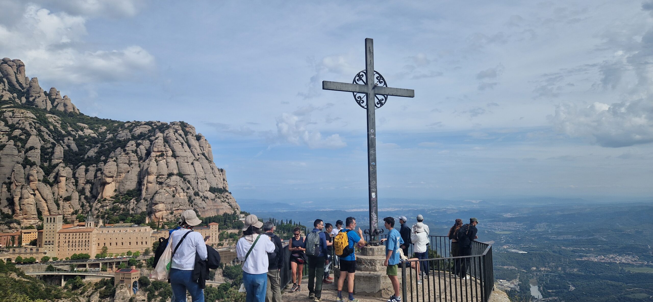
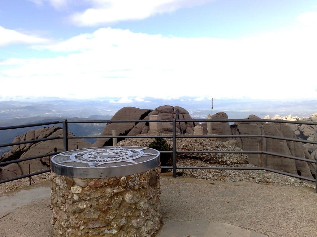
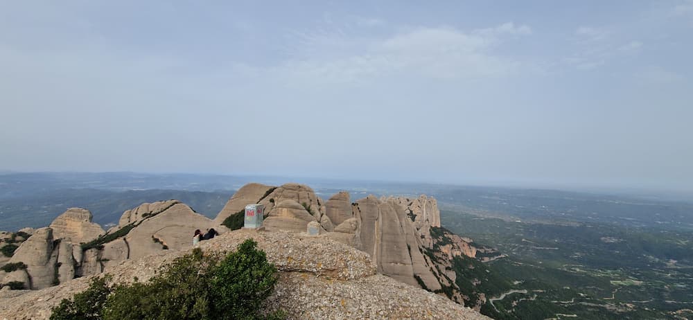
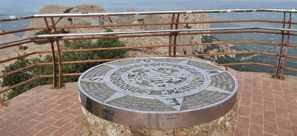
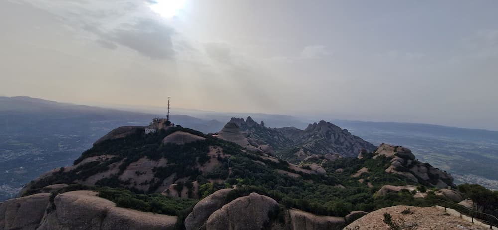
At 1,236 meters, Sant Jeroni is the highest point on Montserrat mountain and the official summit most visitors aim for when hiking to the top of Montserrat. It is also the final reward of the Sant Jeroni hike, one of the best viewpoints in Catalonia and one of the highlights of any visit to Montserrat. From the top, you can see:
- The Pyrenees (on clear days)
- The Mediterranean
- The entire Montserrat massif
How long does the Sant Jeroni hike take?
- From Sant Joan:
→ 1h – 1h 30 min (one way) - Round trip:
→ 2h – 3h
If you include stops, photos, or a relaxed pace, plan around half a day for the Sant Jeroni hike.
Difficulty: is this hike easy?
This is considered the easiest way to reach Sant Jeroni, but it’s still a mountain hike.
Suitable for:
- Casual hikers
- Tourists with decent fitness
- Families (older children)
Not ideal for:
- People with mobility issues
- Very young children without preparation
Practical tips
- Bring water (there are no water fountains along the route). You can buy water at the upper station of the Sant Joan Funicular. There are also restrooms.
- Wear appropriate footwear (no street shoes). The route includes rocky sections, stairs, and sandy areas.
- Avoid the midday heat in summer. Although there are shaded sections, it is always best to avoid the hottest part of the day.
- Check the weather conditions before setting out. Remember that conditions can change quickly in the mountains.
Ways to reach Sant Jeroni in Montserrat
Reaching Sant Jeroni, the highest point in Montserrat, is not limited to a single trail. There are several ways to get to the summit, and that is part of what makes this mountain so special. Some routes are short and accessible, others are longer, wilder, and far more demanding.
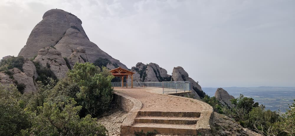
The easiest Sant Jeroni hike is the one explained in this article: starting at the Sant Joan funicular upper station and following the well-marked path to the summit. For most visitors, this is the best option. It avoids most of the steep ascent, follows easy paths for much of the route, and includes several scenic points where you can stop, catch your breath, and enjoy the views. Along the way, you’ll pass natural viewpoints, classic rock formations, and some of the most iconic landscapes in Montserrat. If you want the best Sant Jeroni route for tourists, this is the one.
That said, there are many other ways to reach the top of Montserrat. Some hikers prefer the classic ascent from the monastery. Others come from the outer access points of the massif, following longer mountain routes that feel more adventurous and remote. In Montserrat, these access points are often described as the four main gateways to the mountain: Collbató, El Bruc, Marganell, and Monistrol. From each of them, it is possible to build a route towards Sant Jeroni summit, with very different levels of difficulty, distance, and scenery.
If you are interested in the different options, here are the main ways to reach Sant Jeroni in Montserrat, ordered from easiest to hardest.
Prefer a guided experience?
Compare the best Montserrat tours from Barcelona — rack railway, small group and private options.
1. From Sant Joan Funicular: the easiest route to Sant Jeroni
This is the route covered in this guide, and for most visitors it is the best way to do the Sant Jeroni hike. Starting from the Sant Joan upper station, you avoid most of the elevation gain and can focus on enjoying the walk itself. The trail is well marked, relatively short, and much more manageable than the alternatives. It is ideal if you want to reach the highest point in Montserrat without turning the day into a demanding mountain trek. Download this route here.
You also get one of the best scenic experiences on the mountain. There are beautiful viewpoints along the way, striking rock formations, and several places to stop and take in the landscape before the final staircase to the summit.
Sant Joan Funicular to Sant Jeroni
Start: Sant Joan upper station · Route type: Out and back · Difficulty: Easy to moderate
Distance: 3.68 km Ascent: 263 m
2. From the monastery: the classic hike to Sant Jeroni
The next easiest option is to start directly from the Montserrat monastery. This is a classic route to the summit of Sant Jeroni, and it feels more like a true mountain climb. Unlike the route from Sant Joan, here you have to start gaining elevation right from the start. The trail includes long uphill stretches, steep staircases, and the classic passage through the Pas dels Francessos, along the Camí Vell de Sant Jeroni, one of the best-known routes to the summit of Montserrat.
This route remains very popular, especially among hikers seeking a more comprehensive tour of Montserrat without committing to one of the major external approaches. It is more demanding than the Sant Joan route, but it is also very rewarding and offers a great sense of progress as the monastery gradually fades behind you.
Montserrat Monastery to Sant Jeroni
Start: Montserrat Monastery · Highlights: Pas dels Francessos · Difficulty: Moderate
Distance: 3.7 km Ascent: 516 m
3. From El Bruc: a direct route with views of Montgròs.
Another way to reach Sant Jeroni in Montserrat is from El Bruc, one of the classic access points to the massif and one of the four gateways to the mountain. This route is less touristy and has a more mountainous feel from the very start. Depending on the specific route, you can traverse impressive sections of Montserrat’s western slope, with a striking rocky landscape and a more secluded atmosphere.
One of the most appealing aspects of this access route is the landscape itself. The area offers sweeping views of Coll de l’Ajaguda and a fantastic vantage point of the summit of Montgròs, one of the most iconic peaks in the massif. It is not the easiest way to reach the summit of Montserrat, but it is a very direct and rewarding option for hikers seeking something beyond the usual tourist routes.
El Bruc to Sant Jeroni
Start: El Bruc · Style: Mountain hike · Difficulty: Moderate to hard
Distance: 4.22 km Ascent: 756 m
4. From Collbató: several routes through one of Montserrat’s great gateways
Collbató is one of the traditional main gateways to Montserrat and offers several possible routes to Sant Jeroni. There is no single route, but rather a variety of routes that can be combined in different ways, depending on the desired duration and difficulty of the hike.
A classic option is to ascend from Collbató via the Camí Vell al Monestir, continuing toward the monastery through the area of the Tebes hermitages. We will then connect with the Camí nou de Sant Jeroni, via the legendary Escales de Jacob.
This results in a long and varied hike, featuring historical interest, changing landscapes, and some of the most beautiful mountainous terrain in the range. It is a much longer route than the one from El Bruc, but also one of the most comprehensive in terms of distance and points of interest.
Collbató to Sant Jeroni
Start: Collbató · Style: Mountain hike · Difficulty: Moderate to hard
Distance: 7.8 km Ascent: 803 m
5. From Marganell: Santa Cecília the most challenging and steepest route
Setting out from Santa Cecília, in the municipality of Marganell, is generally considered the most direct way to reach Sant Jeroni. It is a route that is far from touristy—it’s very specific, physically demanding, and steep. For many hikers, this is one of the best ways to quickly reach the highest point of Montserrat. Download this route here.
This side of the massif has a different character: more alpine, gloomy, and steep, with less tourist infrastructure. It is a very attractive route if you want to avoid the busiest sections around the monastery, but it is clearly much more demanding than the options from the other access points mentioned earlier.
Marganell to Sant Jeroni
Start: Marganell · Style: Alpine mountain hike · Difficulty: Hard to extreme
Distance: 2.38 km Ascent: 554 m
6. From Monistrol: the longest and most demanding route
Finally, you can reach the summit of Sant Jeroni from Monistrol de Montserrat, one of the most challenging routes to the top of Montserrat in terms of distance and elevation gain. It is a long and demanding mountain route that crosses several sections of the massif before finally reaching the highest peak. It offers a unique experience along little-traveled trails such as the Canal del Pou del Gat and the Serra de Lluernes.
This route to Sant Jeroni is suitable for experienced hikers who want to spend a long day in the mountains and are comfortable with the sustained climb, route planning, and physical effort it requires. However, for those for whom it is suitable, it is one of the most rewarding ways to reach Sant Jeroni through the fourth gateway to the Montserrat mountain.
Monistrol to Sant Jeroni
Start: Monistrol · Style: A long and physically demanding route · Difficulty: Hard
Distance: 8.7 km Ascent: 1007 m
Comparison table: the 6 main ways to reach Sant Jeroni
There are several ways to reach Sant Jeroni, the highest point of Montserrat, and they vary a lot in difficulty, atmosphere, and type of experience. The route from Sant Joan Funicular is the easiest and best option for most visitors, while the outer approaches from places such as Monistrol, Santa Cecília, or Collbató are much more demanding and better suited to experienced hikers.
The table below compares the main access routes to Sant Jeroni, ordered from the easiest option to the most demanding and extreme ones.
| Route | Difficulty | Start point | Best for | Main character |
|---|---|---|---|---|
| Sant Joan Funicular → Sant Jeroni | ★★☆☆☆☆ Easy to moderate | Sant Joan upper station | Most visitors and casual hikers | Easiest, shortest and most scenic tourist-friendly route |
| Montserrat Monastery → Sant Jeroni | ★★★☆☆☆ Moderate | Montserrat Monastery | Visitors wanting a fuller and more classic hike | Classic ascent with steep stair sections and the Pas dels Francessos |
| El Bruc → Sant Jeroni | ★★★★☆☆ Moderate to hard | El Bruc | Hikers looking for quieter trails and a stronger mountain feel | Direct western approach with views of Montgròs and less crowded terrain |
| Collbató → Sant Jeroni | ★★★★☆☆ Hard | Collbató | Strong hikers wanting a long and varied mountain day | Historic southern access with multiple route options and varied scenery |
| Santa Cecília → Sant Jeroni | ★★★★★☆ Hard to extreme | Marganell | Hikers wanting the steepest and most direct serious route | Very steep outer approach with alpine feel and very little tourist traffic |
| Monistrol → Sant Jeroni | ★★★★★★ Very hard | Monistrol de Montserrat | Experienced hikers comfortable with long ascents and route planning | A long and challenging hiking trail through the mountain range |
Final recommendation
If you’re visiting Montserrat and want a memorable hike without turning your day into a full mountain expedition, this is the route to choose. Take the Sant Joan funicular and hike to Sant Jeroni
If you’d prefer a guided experience, check out our selection of the best Montserrat tours from Barcelona.
If your goal is to experience the best summit hike on Montserrat mountain without choosing one of the hardest routes, the Sant Joan funicular route to Sant Jeroni is the option I would recommend first.
You’ll get:
- The best views
- A manageable hike
- One of the top experiences in Montserrat
Planning the Sant Jeroni hike from Barcelona?
Compare the easiest ways to reach the trailhead: guided tour, transport pass, rack railway or cable car.
Prefer a guided experience?
Compare the best Montserrat tours from Barcelona — rack railway, small group and private options.
FAQ
Is Sant Jeroni the best Montserrat mountain Barcelona hike?
For many visitors, yes. If you are looking for a Montserrat mountain Barcelona hike with panoramic views, a clear route and a manageable level of difficulty, Sant Jeroni from the Sant Joan funicular is one of the best options.
Can beginners do the Sant Jeroni hike?
Yes, if they have decent fitness and choose the route from the Sant Joan funicular. It is still a mountain hike, but it avoids most of the steep ascent from the monastery.
How do you get to the Sant Jeroni hike from Barcelona?
First travel from Barcelona to Montserrat by train, rack railway, cable car or guided tour. Then take the Sant Joan funicular from the monastery area to start the easiest route to Sant Jeroni.
Continue exploring Montserrat

If this guide helped you plan your visit, then it has done its job.
Sergio López Prieto · Local Montserrat Expert
Some links may be affiliate links, at no extra cost to you.